Scan to BIM Historic Building in Rolvsøy
This scan to BIM historic building project in Rolvsøy focused on a residential house originally built around 1890. Over the years, the property changed several times. A hagestue was added, and the roof volume was modified. However, the available plans no longer matched the real structure. Therefore, the owner needed accurate building documentation before any future municipal process, renovation planning, or technical review could move forward.
Ringstadhavna used 3D scanning to capture the house in its current condition. This method created a reliable as-built basis for architects and engineers who need exact geometry, not estimates. As a result, the project moved from incomplete records to a measured digital reference that reflects the building as it stands today.
Scan to BIM Historic Building Survey of Existing Conditions
Historic houses often contain irregular walls, slight level changes, and later additions that are difficult to record by hand. In this case, the residence had developed through several building phases. Because of that, manual measurement alone would have created unnecessary risk and inconsistency.
Instead, the property was documented through building measurement scanning. The 3D laser scanning process recorded facades, interiors, roof geometry, and structural relationships as a dense point cloud. This gave the team a dependable base for building documentation, consultant coordination, and future decision-making.
Scan to BIM Historic Building Modeling and Drawing Production
After the survey, the captured data was processed into a structured digital model. This is where the scan to BIM historic building workflow becomes especially useful. First, the point cloud preserves the real geometry. Then, that geometry is converted into technical documents that architects and engineers can use directly.
The model reduced manual interpretation and improved consistency across the full drawing set. In practice, this made it easier to prepare structural documentation, compare original and later building elements, and support renovation planning with measured information. It also follows the same broader BIM logic used in open digital workflows described by buildingSMART.
Scan to BIM Historic Building Documentation Delivered in Rolvsøy
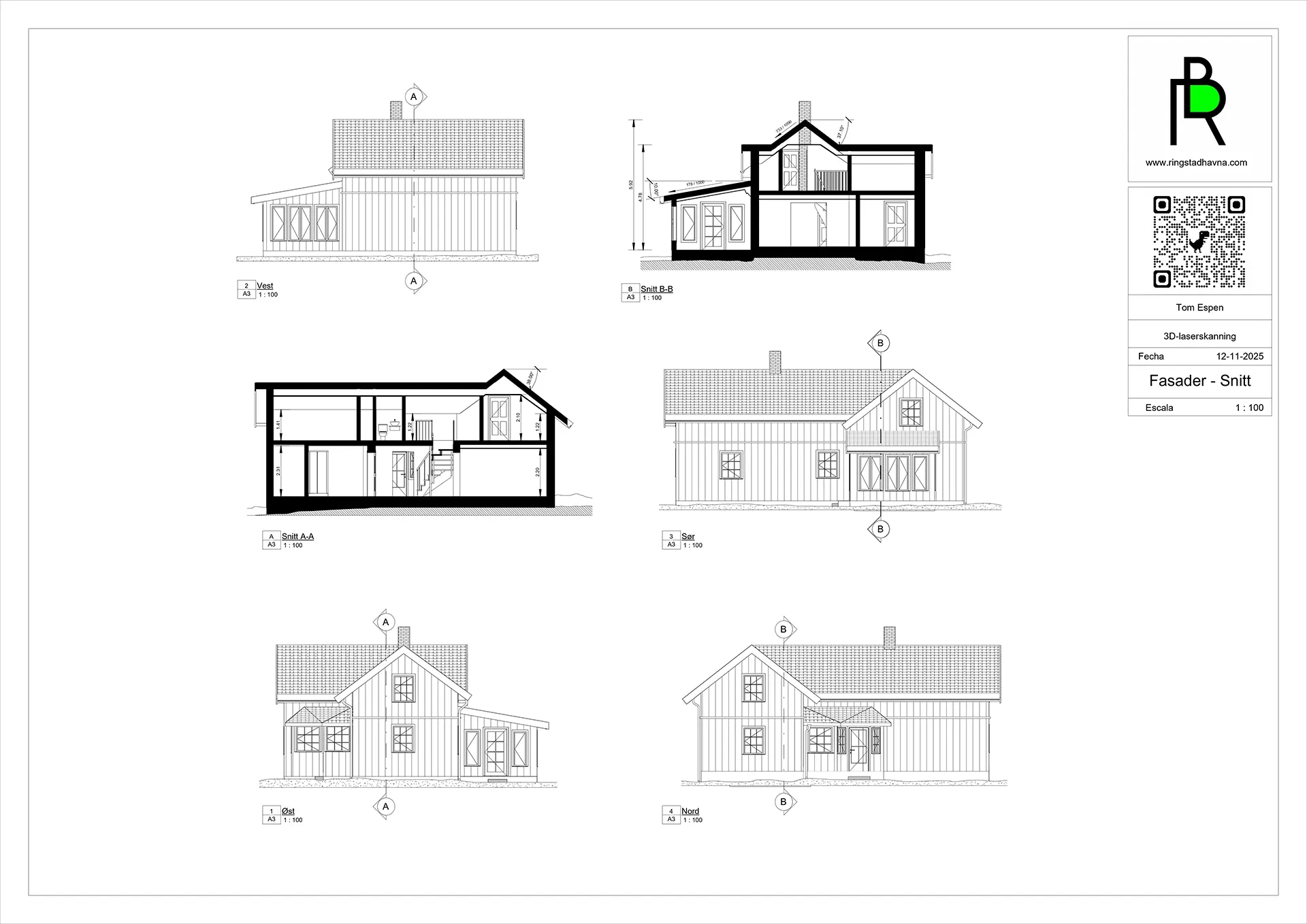
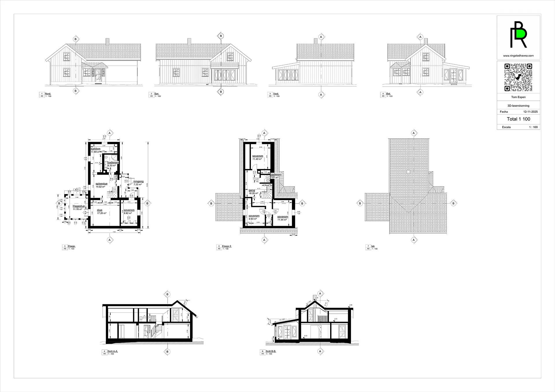
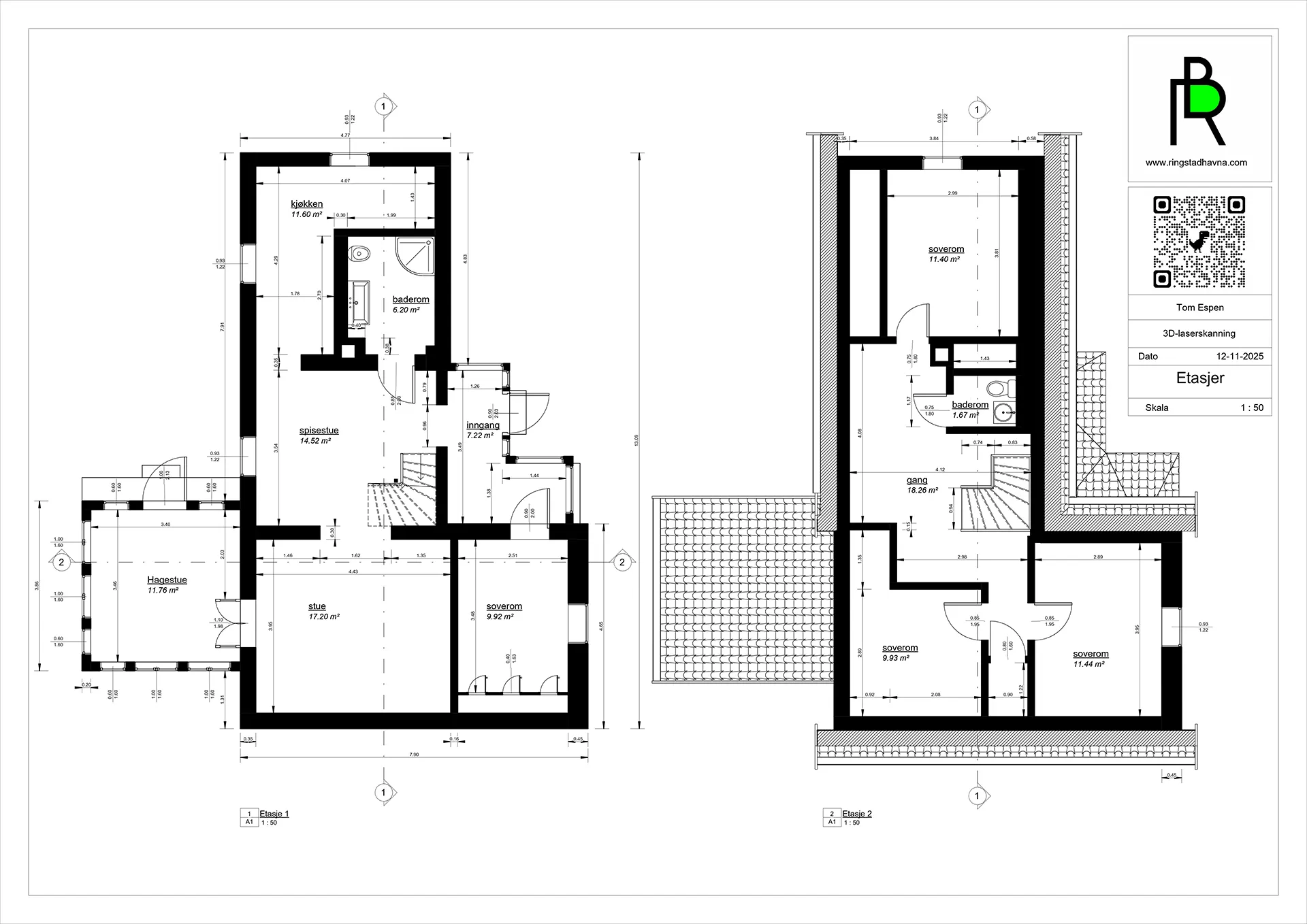
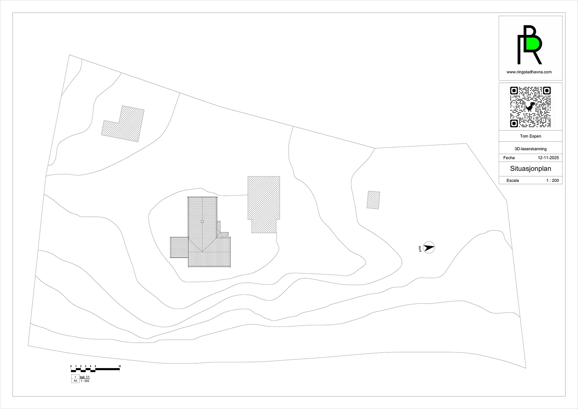
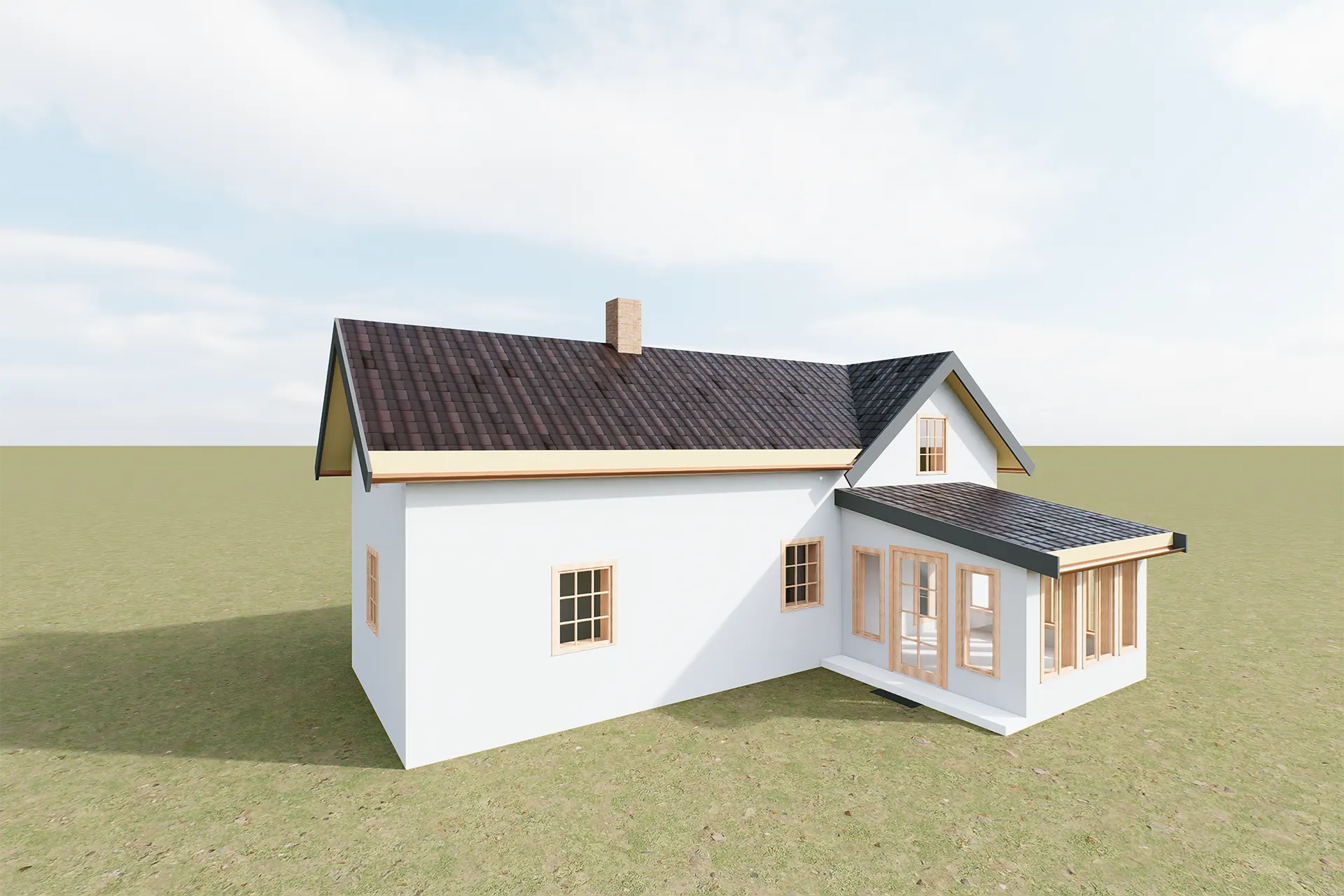
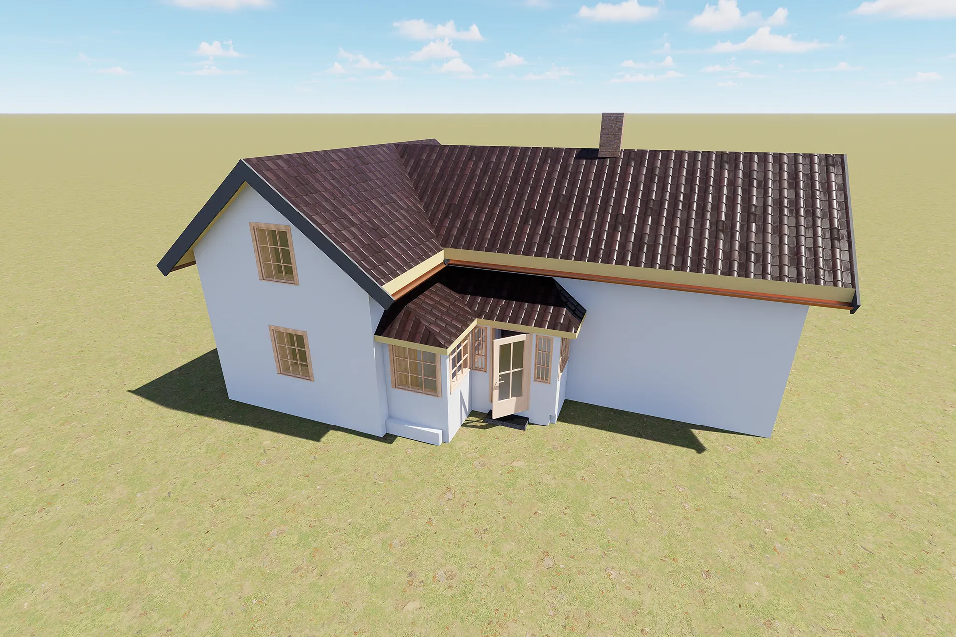
The final package included floor plans for both levels, sections showing height relationships and roof slopes, facade drawings, a site plan, and 3D visualizations. These documents identified the kitchen, living areas, bedrooms, and the later hagestue extension. In addition, they clarified how the original house connects with later modifications.
Because the drawing set came from measured data, it provides a stronger technical base for owners, consultants, and public authorities. It also fits naturally with other documented work in the projects section and supports the same precision used in renovation-focused scanning projects.
Why This Scan to BIM Historic Building Project Matters
This scan to BIM historic building project gives the owner several practical advantages. First, it helps align formal records with the current physical condition of the house. Second, it creates a better base for future byggesøknad work. Third, it improves transparency for valuation, financing, and sale. Finally, it provides a long-term roadmap for maintenance and repair in an older structure.
For architects, the value is straightforward: better measured data leads to better design decisions. For owners, the benefit is just as clear: fewer surprises, stronger documentation, and more control over future work. If a similar property needs accurate existing-condition records, the next step is to contact Ringstadhavna.
Project Summary
- Location: Rolvsøy, Norway
- Building type: Historic residential house
- Original date: Approx. 1890
- Main task: Existing-condition documentation
- Method: 3D laser scanning and BIM modeling
- Deliverables: Plans, sections, facades, site plan, renders
Project FAQ
Why use scan to BIM for a historic building?
A historic house often contains irregular geometry and undocumented changes. Scan-to-BIM gives architects an accurate as-built base for renovation planning, municipal submission, and design coordination.
What documents were produced for this Rolvsøy house?
The project included floor plans, sections, facade drawings, a site plan, and 3D visualizations based on measured building geometry.
How does this help with municipality work?
It gives the owner a documented record of the house in its current state. That helps align formal records with physical reality and supports future permit processes.
Is this workflow useful only for historic houses?
No. The same method is useful for extensions, remodeling, subdivision projects, and general as-built documentation in newer buildings as well.