Scan to BIM Historic Farm in Rolvsøy
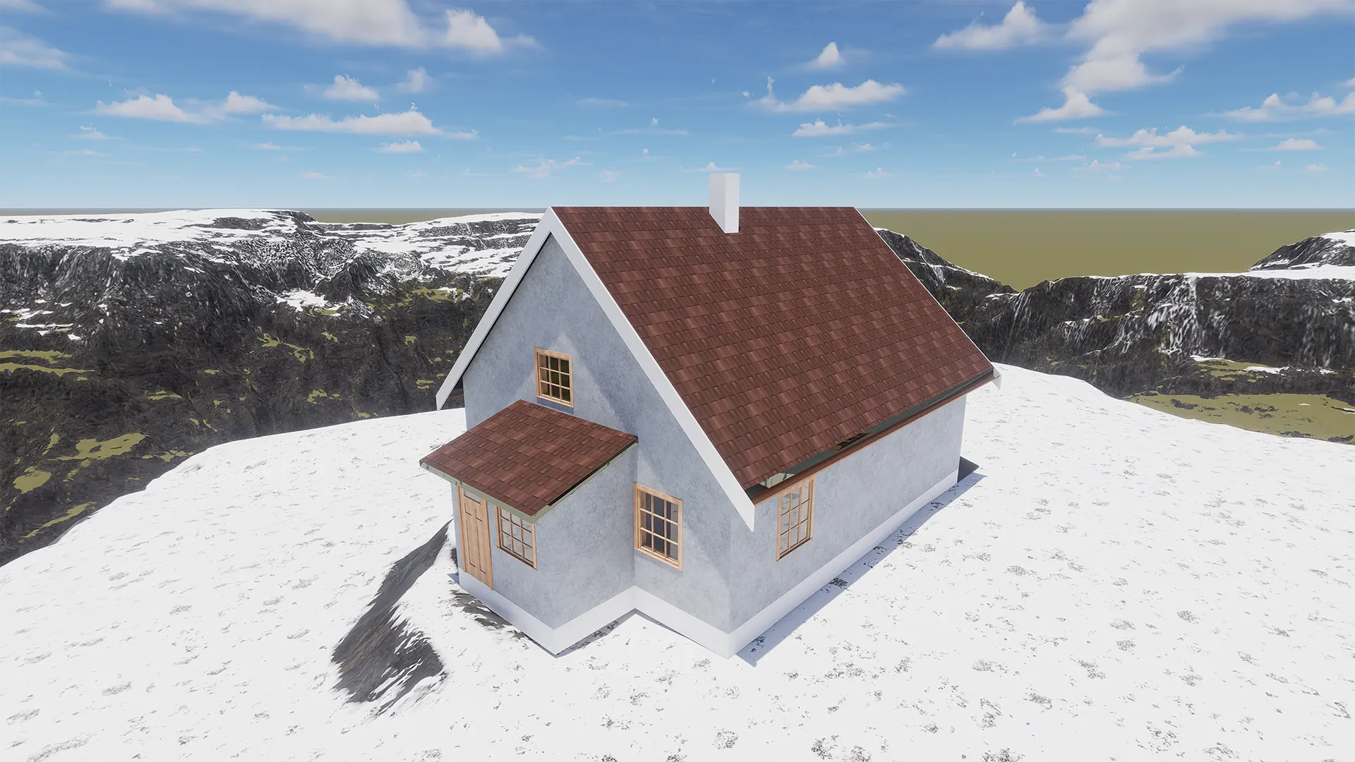
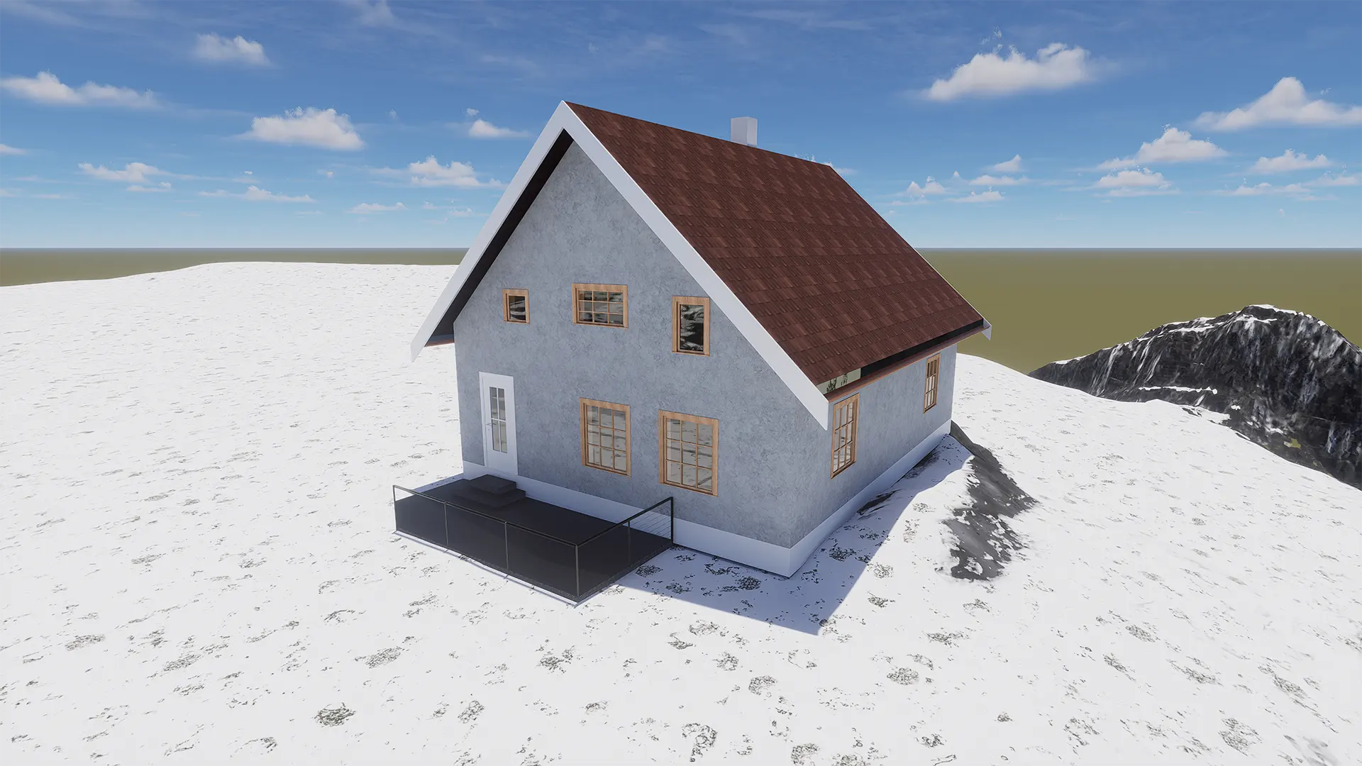
Scan to BIM historic farm describes the documentation workflow used for a historic property at Enghaugen Gård in Rolvsøy, Norway. The farmhouse consists of an original building from 1740 and a later extension built around 1840. Over time, structural changes, repairs, and settlement altered the geometry of the building. Therefore, the owner required accurate building measurement and reliable building documentation before planning future renovation work.
Traditional measuring techniques would have required large amounts of manual interpretation. Instead, Ringstadhavna performed a full laser scanning survey. As a result, the project produced a dense point cloud that captured the building exactly as it exists today. This approach provides a far more reliable basis for renovation planning, structural analysis, and design coordination.
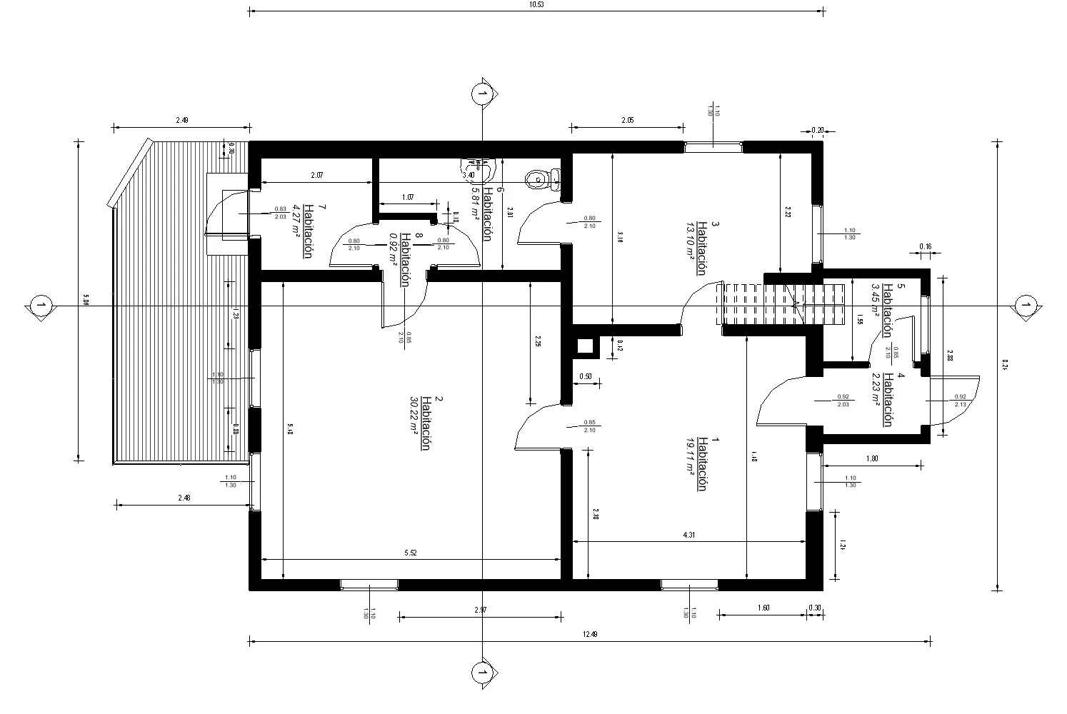
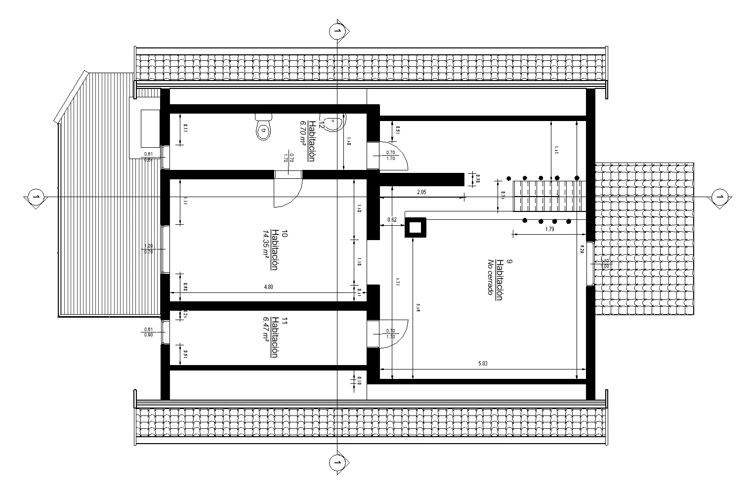
Measured documentation of a historic farm building
Historic buildings rarely follow predictable geometry. Walls may lean, floors may shift, and extensions may connect at irregular angles. Consequently, precise digital documentation becomes essential. In this project, the goal was to create a technical reference that architects and engineers could trust during later project stages.
The survey captured both the 1740 farmhouse and the 1840 extension as a single spatial structure. Because the dataset records millions of measurement points, the resulting documentation reflects real construction conditions rather than theoretical drawings. Similar workflows can also be seen across other Ringstadhavna projects where accurate geometry supports design and construction planning.
Laser scanning and BIM modelling workflow
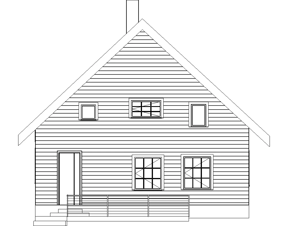
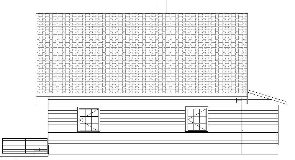
The project used Faro Focus Premium laser scanning equipment. This technology captures high-resolution spatial data from multiple scanning positions around the building. Each scan contributes to a combined point cloud representing the entire property. Consequently, ridge heights, wall positions, and structural irregularities can be measured with a high degree of precision.
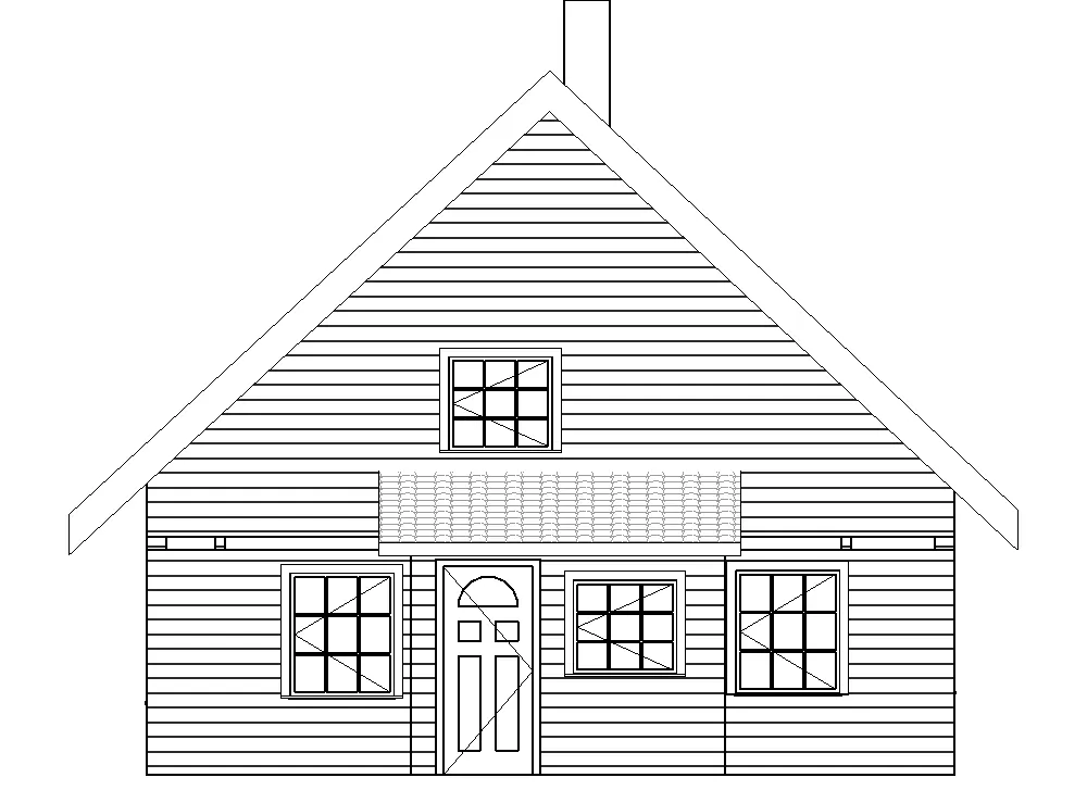
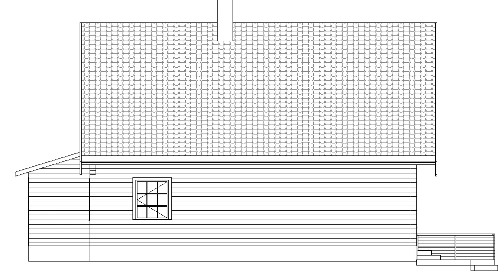
After field capture, the data was processed and imported into Autodesk Revit. At this stage, the point cloud served as the base for a coordinated BIM model. This model allows the extraction of floor plans, sections, and elevations. Moreover, it creates a consistent reference for consultants working on the same building.
Because the workflow follows a scan to BIM historic farm methodology, the model reflects the real geometry of the structure rather than simplified assumptions. For example, uneven wall lines and subtle structural deviations remain visible in the BIM environment. This level of detail is particularly important for historic properties.
Supporting renovation and preservation planning
The final documentation provides a reliable technical foundation for future work on the farm. Architects can analyse spatial relationships more clearly. Engineers can evaluate structural conditions with better context. Meanwhile, the owner gains a long-term digital reference of the building.
Furthermore, digital documentation simplifies communication between project participants. Instead of interpreting fragmented measurements, everyone can refer to the same coordinated model. As a result, design decisions become more transparent and easier to validate.
The scan to BIM historic farm workflow therefore creates value beyond the survey itself. It reduces uncertainty, improves coordination, and supports informed renovation planning. Additional examples of measured documentation can be explored in the historic barn project, the outdoor design scanning project, and other technical cases described on the company overview page. Project-specific questions can also be sent through the contact page.
Project Summary
This project documented a historic farm property at Enghaugen Gård in Rolvsøy. The building includes a farmhouse from 1740 and an extension from 1840. Ringstadhavna carried out a full laser scanning survey using Faro Focus Premium and processed the data in Autodesk Revit. The resulting BIM model provides accurate building documentation, measured drawings, and a dependable base for renovation planning and future preservation work.
Project FAQ
Why use scan-to-BIM for a historic farm?
Laser scanning records the real geometry of the building. The BIM model then converts that data into usable drawings and digital documentation.
What deliverables are created in this workflow?
The workflow typically produces a point cloud, a Revit BIM model, and measured drawings such as plans, sections, and elevations.
How does this help renovation planning?
Accurate geometry reduces uncertainty. Therefore, architects and engineers can design renovations based on reliable data rather than estimates.