3D Scanning for Residential Subdivision in Gamle Fredrikstad
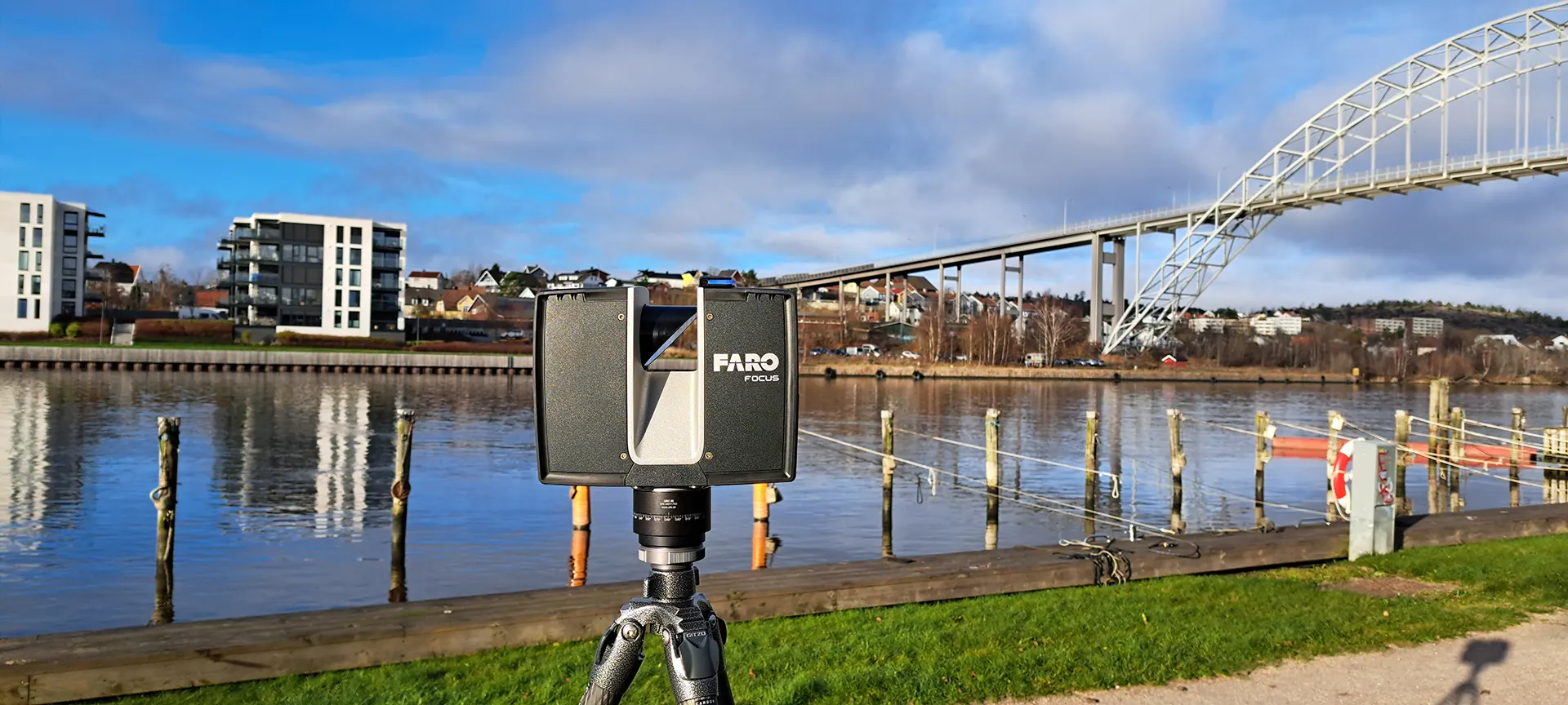
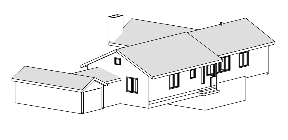
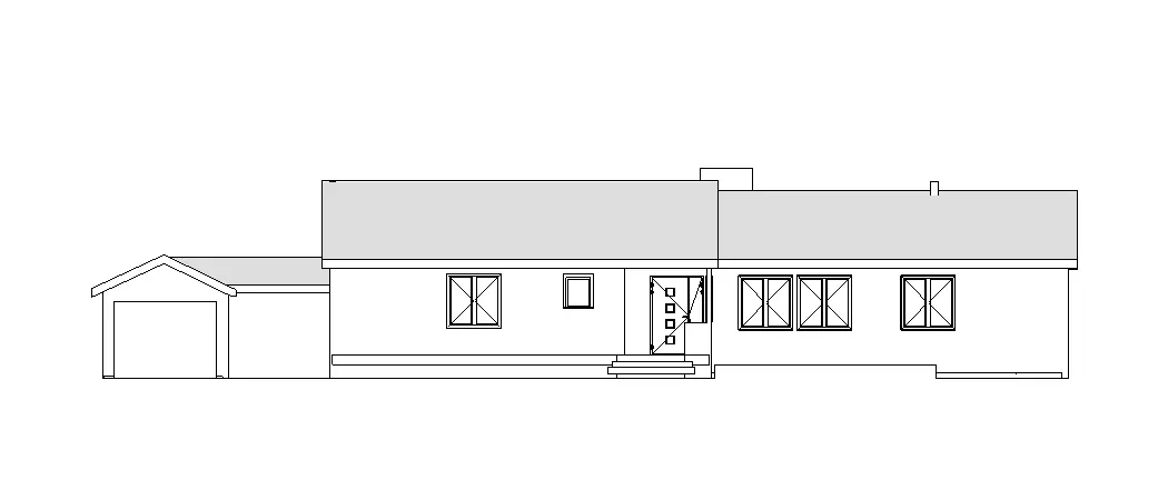
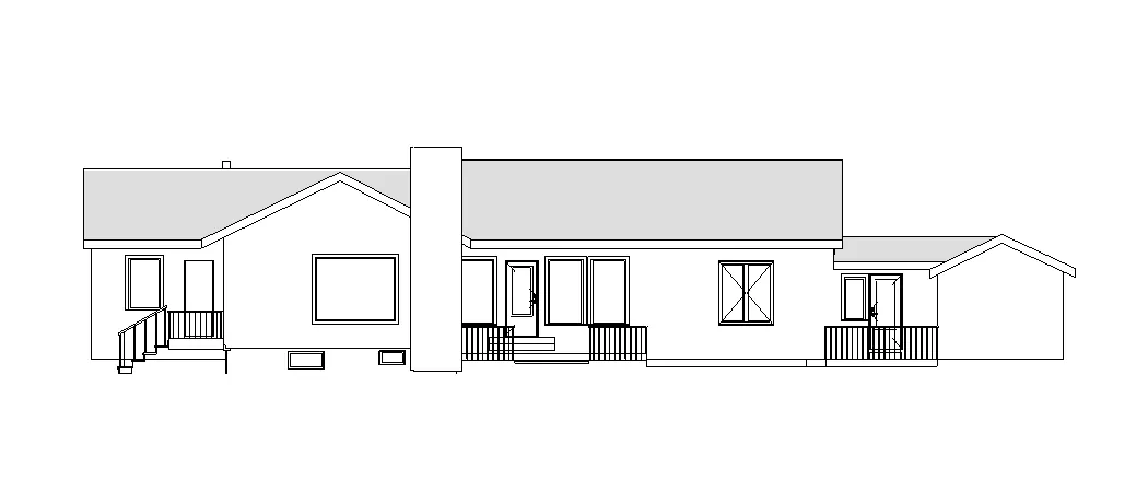
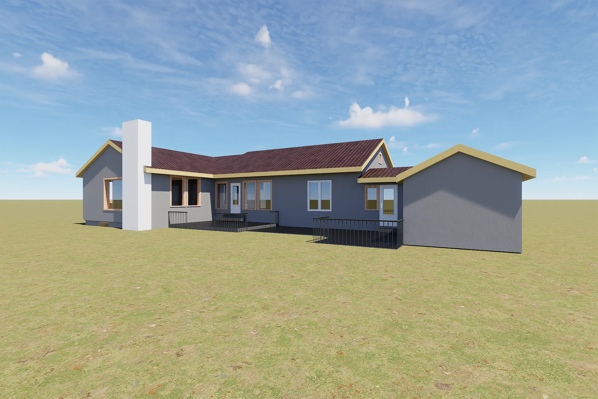
The Prestelandet 19 project in Gamle Fredrikstad began with a clear architectural objective: convert an existing single-family house into two independent residential units for short-term rental. To support that process, 3D scanning for residential subdivision was used as the base method for accurate building documentation, reliable building measurement, and early design control. As shown across Ringstadhavna’s 3D scanning services, this workflow gives architects and engineers a measured digital foundation before layout decisions, utility coordination, or permit drawings begin.

Project Context and Existing Conditions
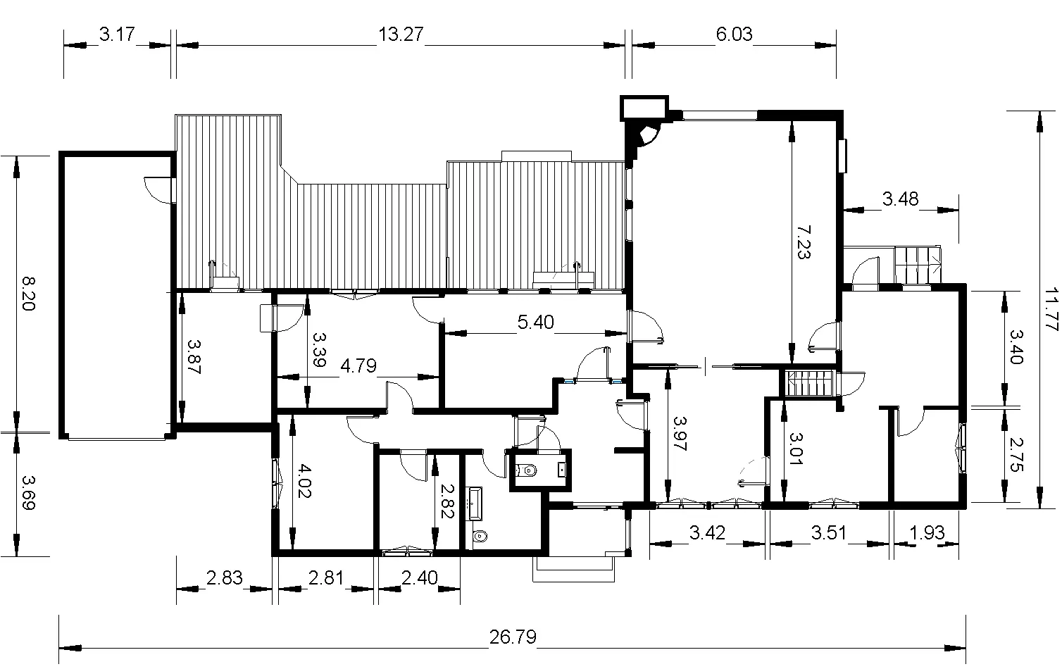
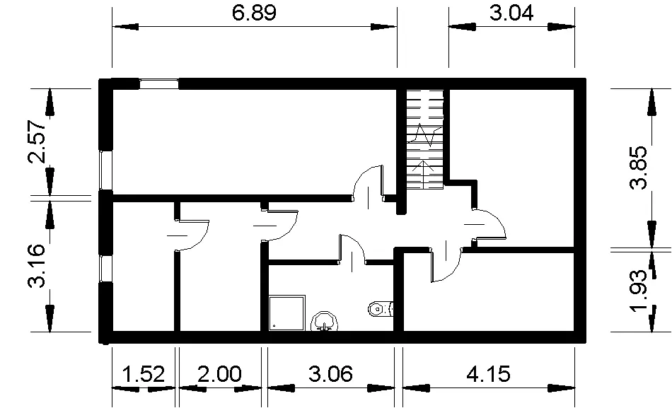
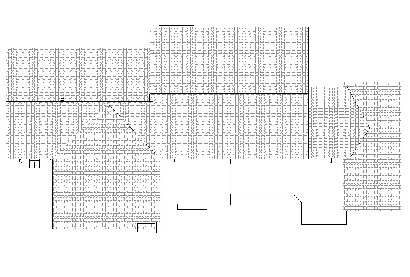
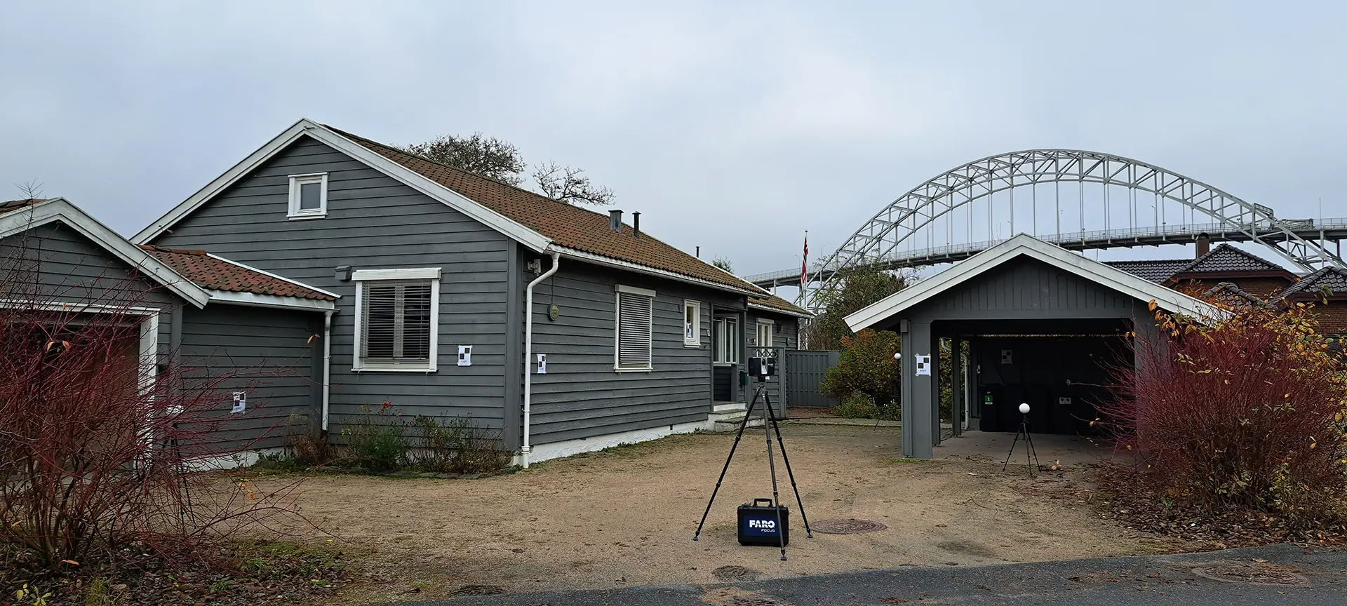
In buildings that have been modified over time, original drawings rarely reflect current conditions. That is especially important in subdivision work, where wall positions, floor levels, ceiling heights, and service routes directly affect feasibility. At Prestelandet 19, the property needed precise structural documentation before any reconfiguration could be tested. Rather than rely on manual checks alone, the team applied a scan-based workflow similar to other cases presented in the projects section and in related residential work such as property subdivision and home renovation.
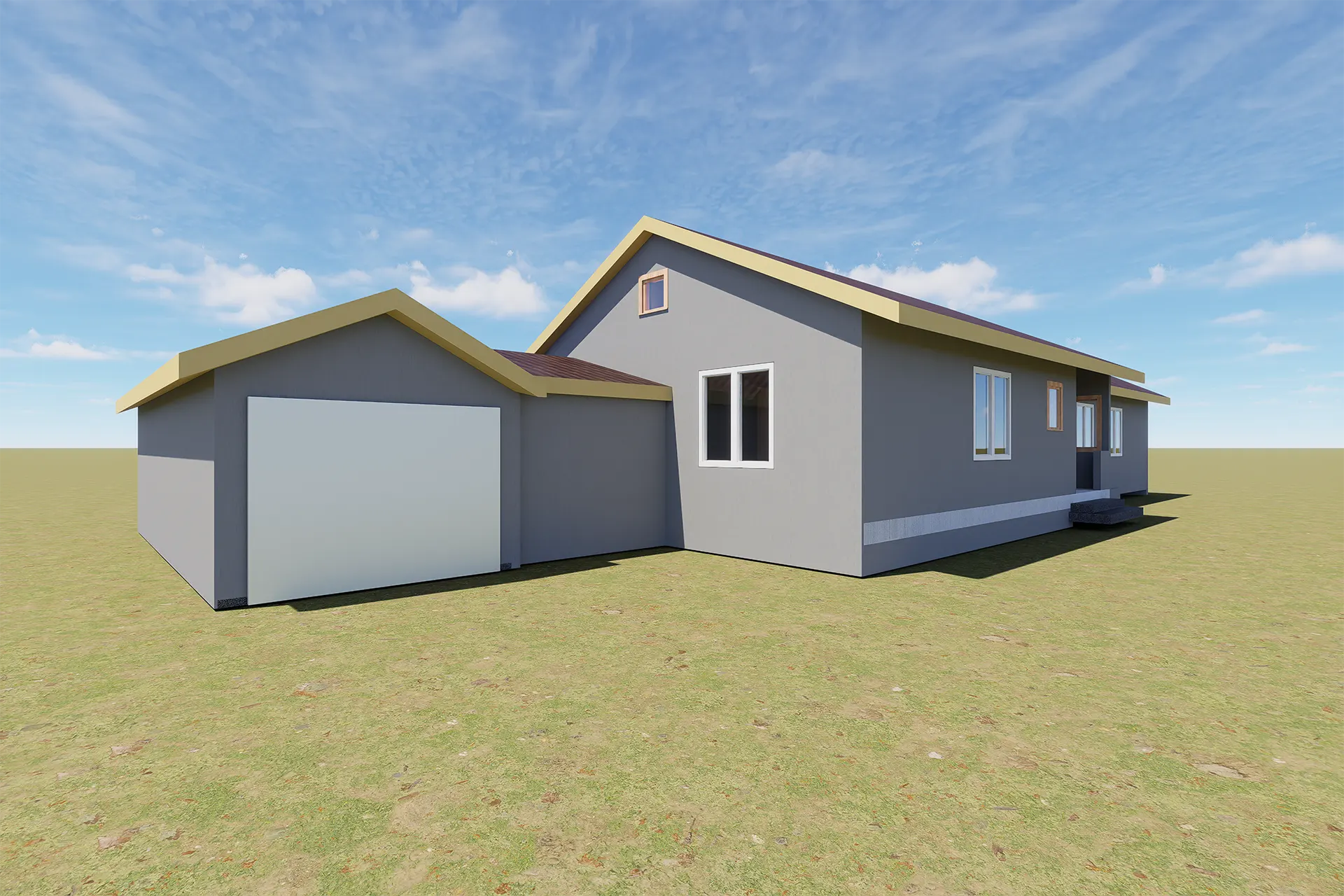
Scan-to-BIM Workflow
The survey phase produced a high-density point cloud that captured the real geometry of the building, including irregularities that often remain hidden in conventional surveys. This dataset created a dependable reference for scan-to-BIM modelling and reduced uncertainty at the start of the design phase. For architects, that means faster comparison of planning options; for engineers, it means a better base for coordination and dimensional control. The same technical logic can be seen in other measured renovation cases, including kitchen remodelling with laser scanning, where accurate as-built data made design development far more predictable.
What the Survey Data Supports
- accurate room geometry for layout studies
- clear section data for approval drawings
- reliable dimensions for service coordination
Subdivision Planning and Technical Analysis
Once the measured model was available, the project moved into analysis and decision-making. The main task was to test how two residential units could be inserted into the existing structure while preserving privacy, functional access, and compliance with fire separation requirements. In this stage, 3D scanning for residential subdivision helped define whether independent circulation could be achieved without wasting usable area. It also supported renovation planning for plumbing, electrical, and ventilation routes needed for the second unit. This type of measured planning is closely aligned with the practical approach described on the main company page and in selected design-oriented case studies such as 3D scanning for outdoor design.
Key Planning Priorities
- independent access for each apartment
- efficient routing for new building services
- compliant fire separation between units
Municipal Documentation Value
For projects in Gamle Fredrikstad, precise technical material is critical when preparing documentation for municipal review. The measured model helps produce floor plans, sections, ceiling-height verification, and other approval drawings based on actual site conditions rather than assumptions. That makes 3D scanning for residential subdivision valuable not only for concept work, but also for later submission quality. Combined with coordinated digital modelling and the expertise outlined on the about us page, the workflow gives the project team a stronger basis for decisions before construction starts
Project Summary
- Location: Gamle Fredrikstad, Norway
- Project type: Residential subdivision study
- Technology: 3D laser scanning and scan-to-BIM
- Goal: Convert one house into two units
- Status: Analysis and design development
Project FAQ
Why use 3D scanning for residential subdivision?
It provides accurate as-built geometry, which is essential when layouts, access, and service routes must be tested inside an existing structure.
How does scan-to-BIM help architects?
It turns measured survey data into a workable digital model that supports layout studies, sections, coordination, and approval drawings.
Can laser scanning improve renovation planning?
Yes. It reduces measurement uncertainty and helps teams coordinate structural constraints, utilities, and room geometry before site work begins.