Mariam House – 3D Scanning Buildings for a Historic Residence
The Mariam House project shows how 3D scanning buildings can solve documentation challenges for complex residential properties. Located in Rolvsøy, this historic residence had been extended and modified over several decades, which made the original drawings incomplete and no longer fully reliable. For renovation planning, municipal review, and future technical work, the property required updated documentation based on its real built condition.
To solve this problem, the building was captured with a modern laser scanning workflow and then reconstructed as a detailed BIM model. This type of process is now widely used in building measurement and digital documentation because it provides accurate geometry, dependable dimensions, and a strong basis for architectural planning. For older houses with many additions, this method is far more reliable than manual measurement alone.
Laser Scanning the Existing Building
The first stage focused on scanning the full structure with a Faro Focus Premium laser scanner. The goal was to record the building exactly as it stands today, including walls, floors, roofs, angles, and visible structural details. The scanning process produced a dense point cloud, which became the digital reference for the next modeling phase. This workflow is especially useful in projects involving laser scanning buildings for renovation planning, where design decisions depend on real geometry rather than outdated drawings.
Compared to traditional site measurement, laser scanning offers several practical advantages:
- Accurate capture of walls, floors, roofs, and openings
- Reliable record of angles, levels, and built geometry
- Fast collection of large volumes of measured data
- Strong support for planning, design, and coordination
For a historic residence like Mariam House, these benefits are particularly important. When a building has changed over time, even small dimensional differences can affect design work, approvals, and construction decisions. That is why many architects now rely on measured renovation case studies as reference points when evaluating similar properties.
From Point Cloud to BIM Model
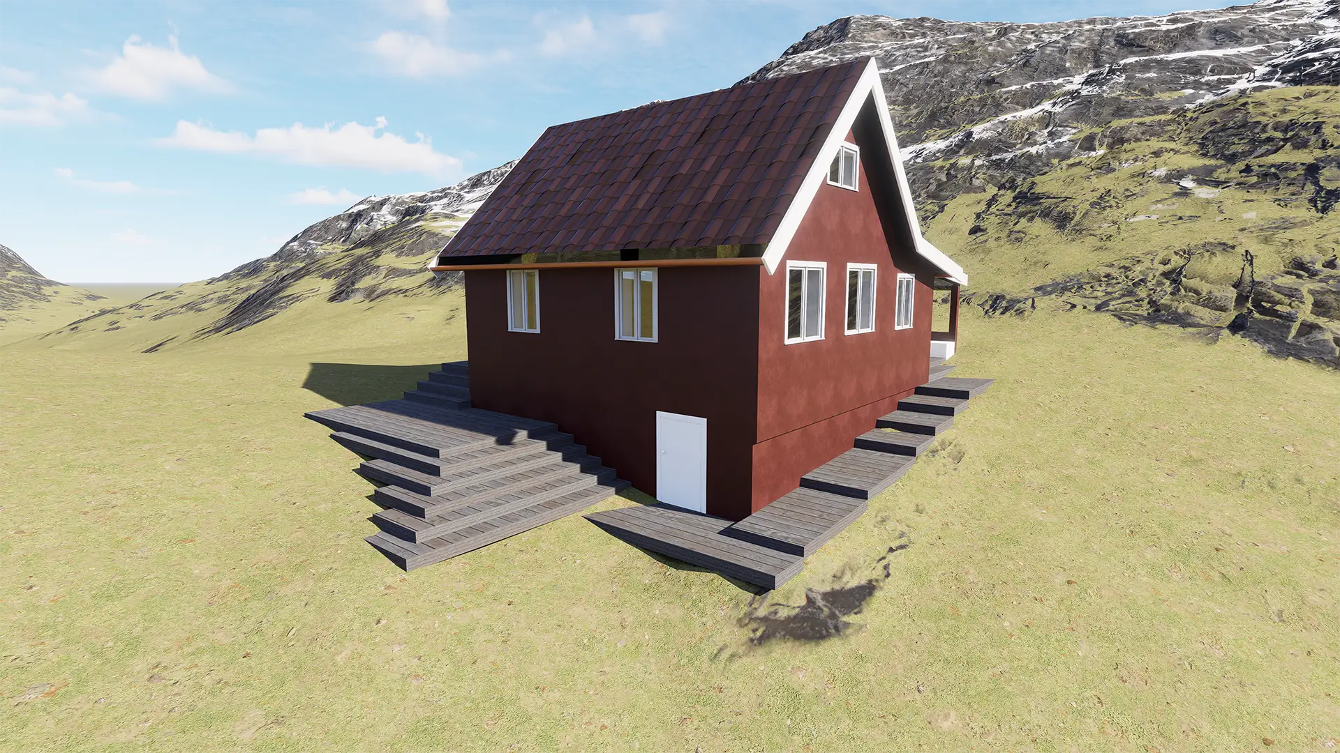
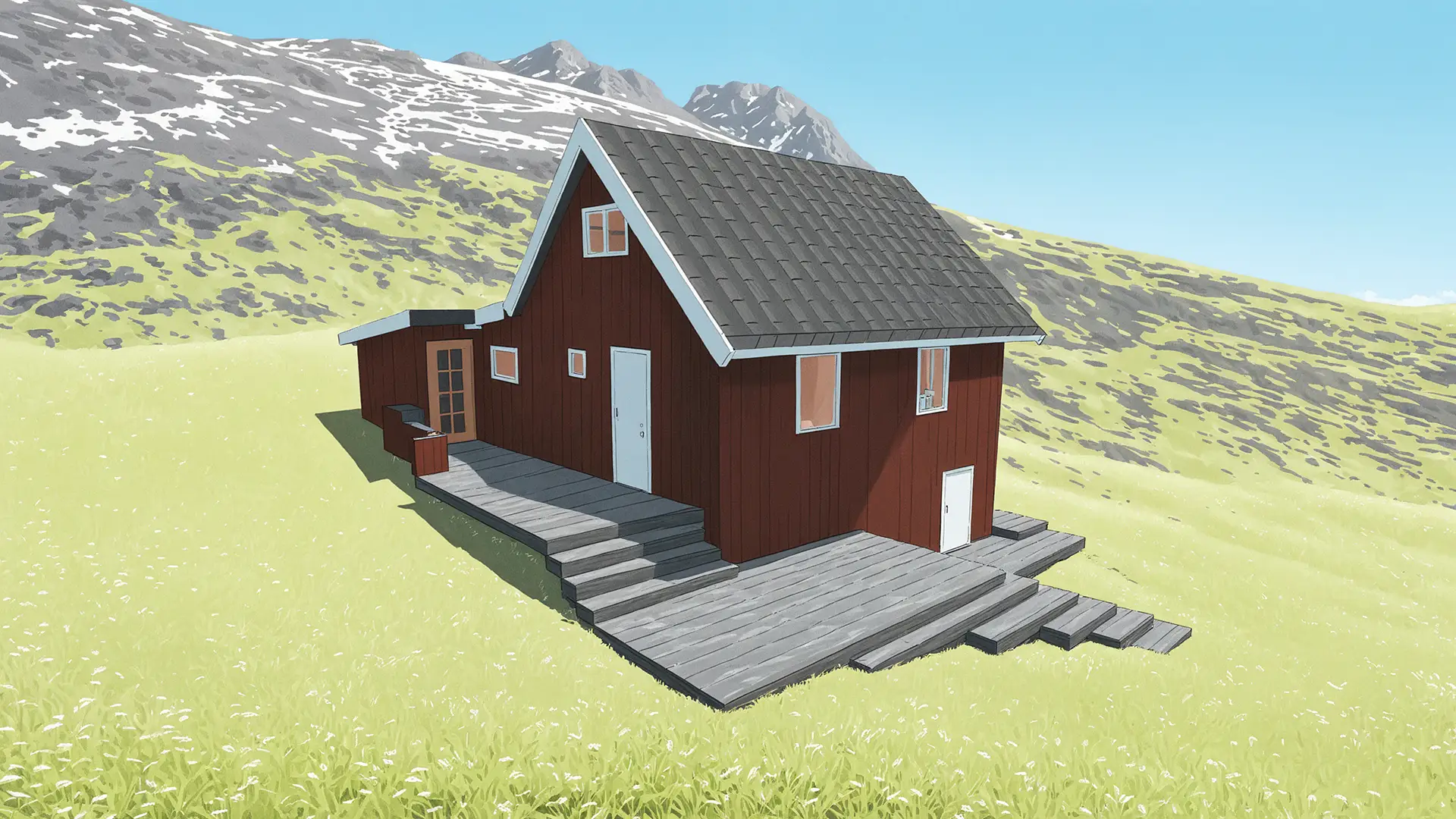
After the scanning phase, the point cloud data was processed in Autodesk Revit through a Scan-to-BIM workflow. The digital survey was translated into a structured BIM model that reflects the current condition of the residence. Instead of working from assumptions, the project team could work from measured geometry and coordinate the building with a much higher level of confidence. This is one of the main reasons why digital modeling and measured geometry workflows are now widely used in both renovation and documentation projects.
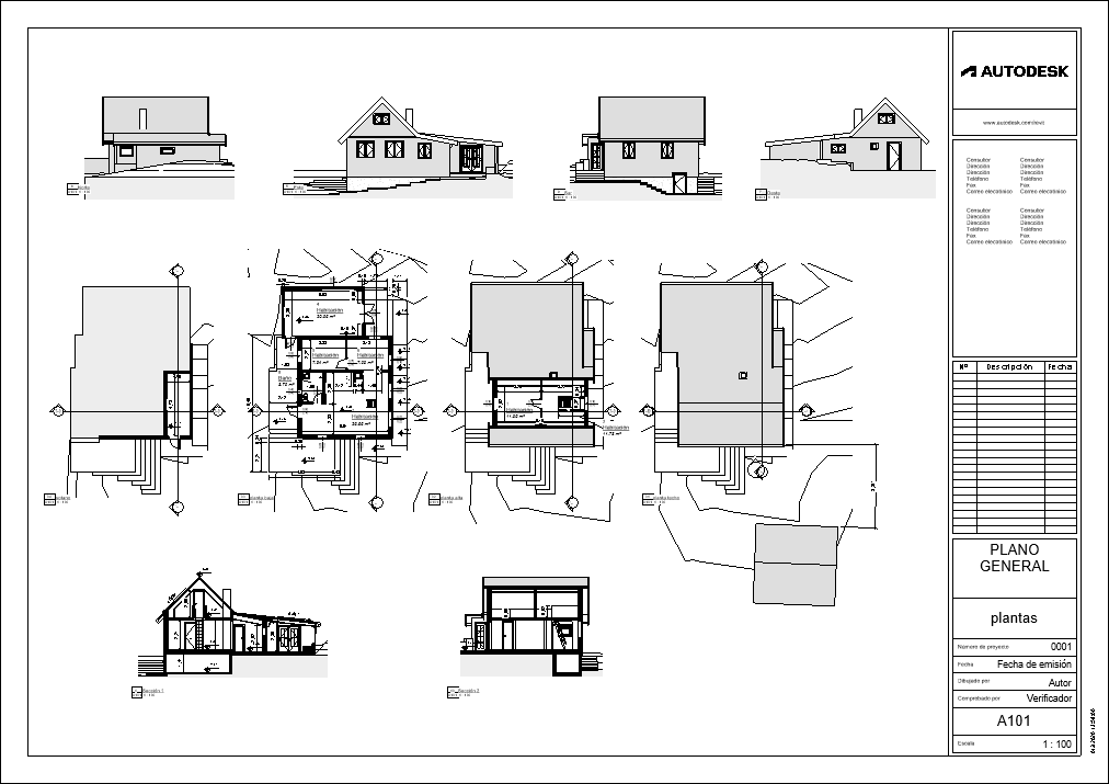
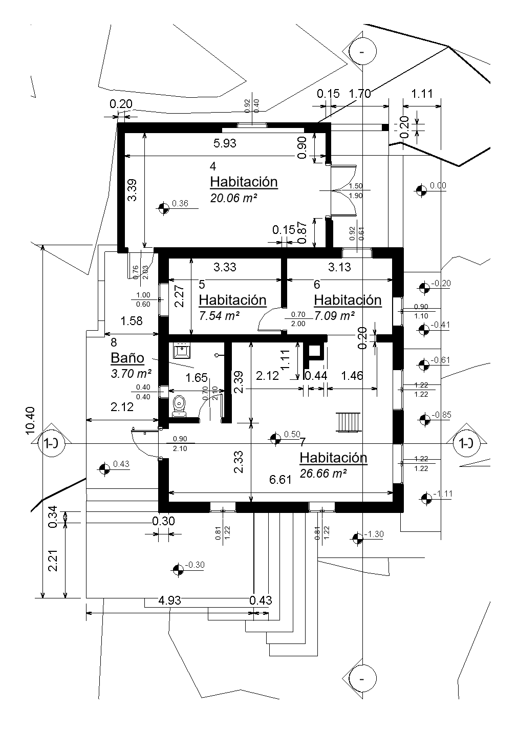
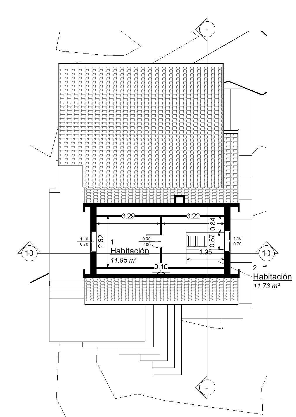
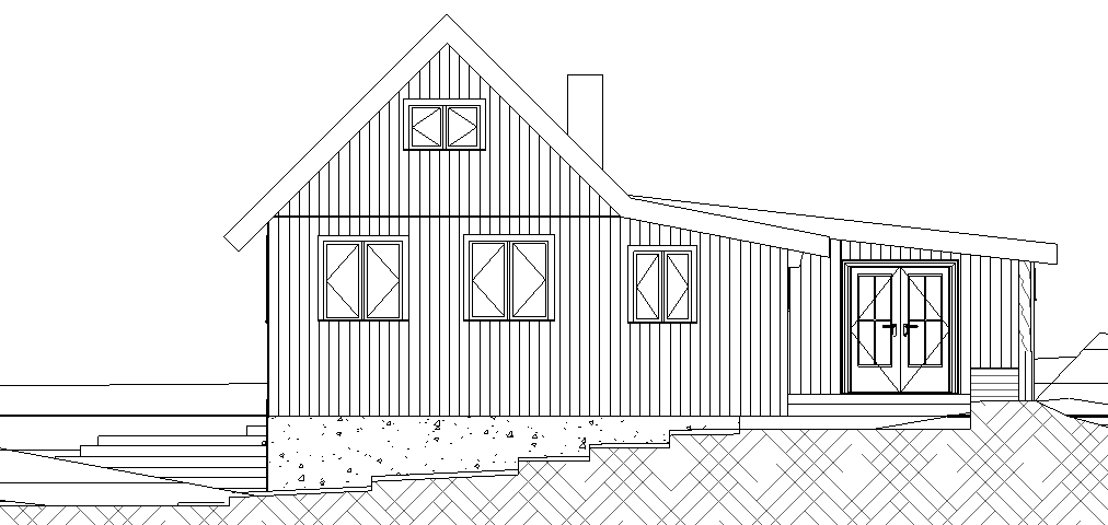
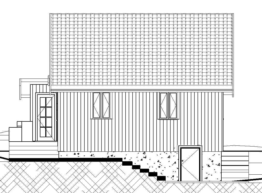
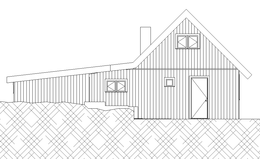
The BIM model was used to organize the key architectural elements of the building, including walls, floors, roof forms, openings, and general building geometry. From this model, the final technical documentation was produced in a form that can be used for planning and review.
- Floor plans for the full residential layout
- Building sections for internal spatial relationships
- Exterior elevations for the current building form
- Measured dimensions for future technical use
This kind of output is valuable not only for architects, but also for engineers, owners, and public authorities. It creates a consistent reference package that reduces technical uncertainty and improves communication between all project participants. For projects that move from digital survey to physical models or prototypes, related workflows can also connect with 3D printing services in Norway.
Technical Value of the Final Model
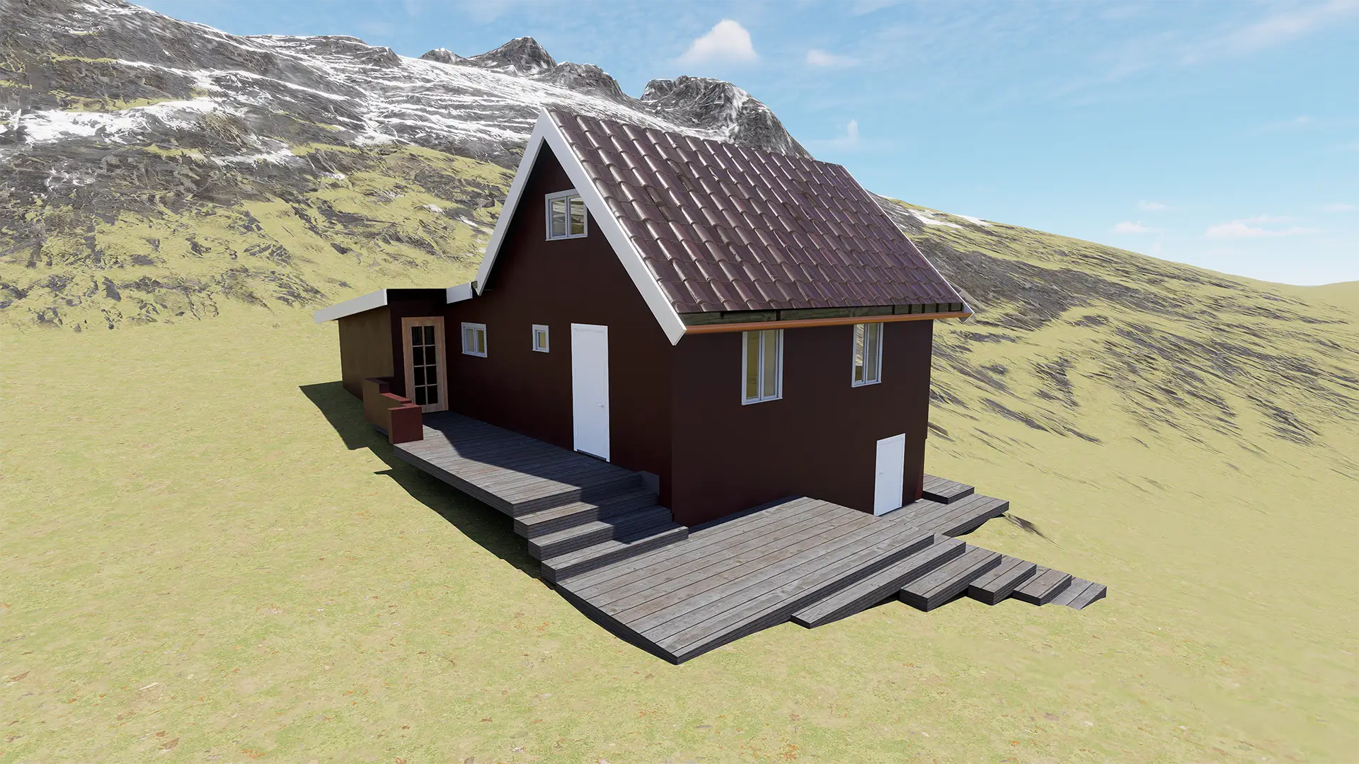
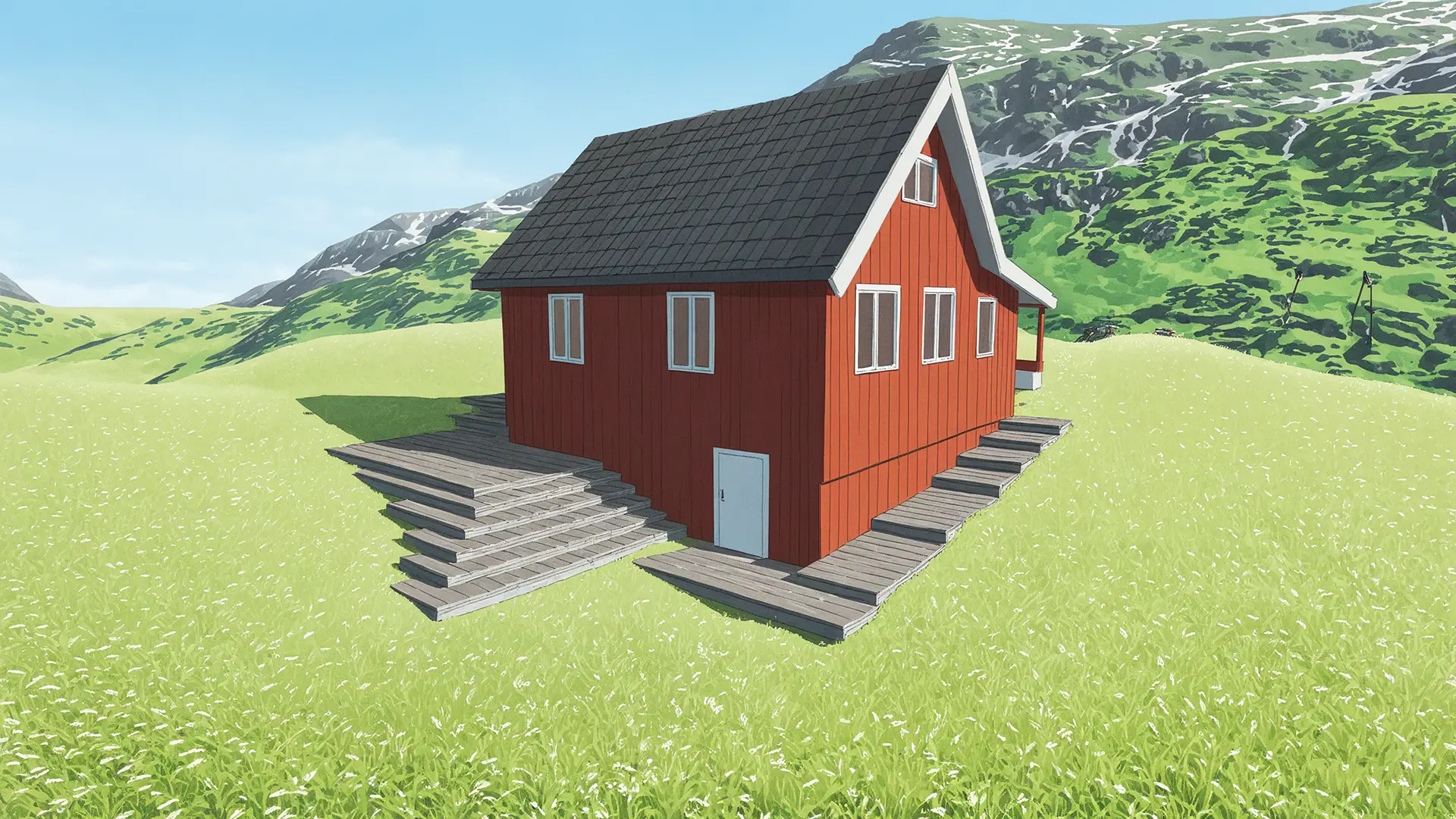
One of the most important results of the Mariam House project was the creation of a digital twin of the residence. Because the BIM model was built from laser scanning data, it reflects the actual physical condition of the property rather than a simplified interpretation. This makes the model useful for renovation studies, maintenance planning, technical coordination, and future design work.
The final result delivered clear technical benefits:
- Millimeter-accurate data for the existing building shape
- Updated drawings based on the built condition
- Reliable geometry for renovation and planning work
- Usable BIM data for long-term building management
This project demonstrates how 3D scanning buildings can support the documentation of historic and irregular residential properties. For buildings with incomplete plans, multiple additions, or complex geometry, laser scanning and BIM modeling provide a dependable path toward accurate technical documentation. Businesses looking for similar solutions can also get in touch with the Ringstadhavna team to discuss project requirements and technical goals.
Results of the Project
The project successfully produced a complete digital reconstruction of the residence. The final deliverables included:
- a high-precision BIM model of the building
- full architectural documentation
- accurate measurement of structural dimensions
- digital records suitable for future renovation projects
Project FAQ
Why is 3D scanning useful for historic buildings?
Historic buildings often lack accurate architectural drawings. Laser scanning captures the exact geometry of the structure and allows engineers to create precise documentation without relying on outdated plans.
How accurate is building laser scanning?
Modern laser scanners can measure surfaces with millimeter precision. This level of accuracy is significantly higher than traditional manual measurement methods.
What is a Scan-to-BIM workflow?
Scan-to-BIM is the process of converting laser scanning data (point clouds) into a structured BIM model. The resulting model can be used to generate architectural drawings and support renovation planning.
Can a BIM model help with future renovations?
Yes. A BIM model acts as a digital reference for the building. Architects and engineers can use it to plan renovations, evaluate structural changes, and coordinate construction work.